World Geography
A collection of Anki flashcard decks for geographic recall. More than just names and capitals, but where things actually sit on the map. I wanted to go beyond knowing “Buenos Aires is the capital of Argentina”, and be able to point to it. Knowing a city’s position relative to its country, its neighbours, and the geography around it should help to make it more memorable in a way that labels alone can’t.
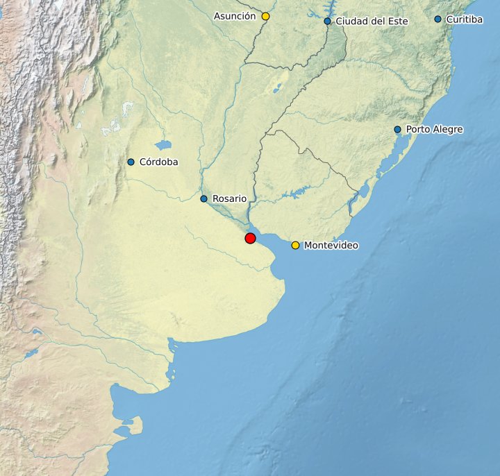
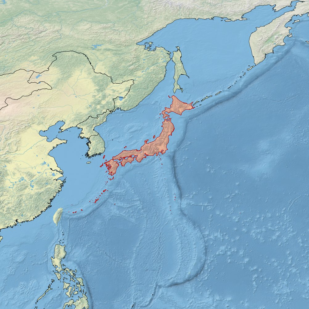
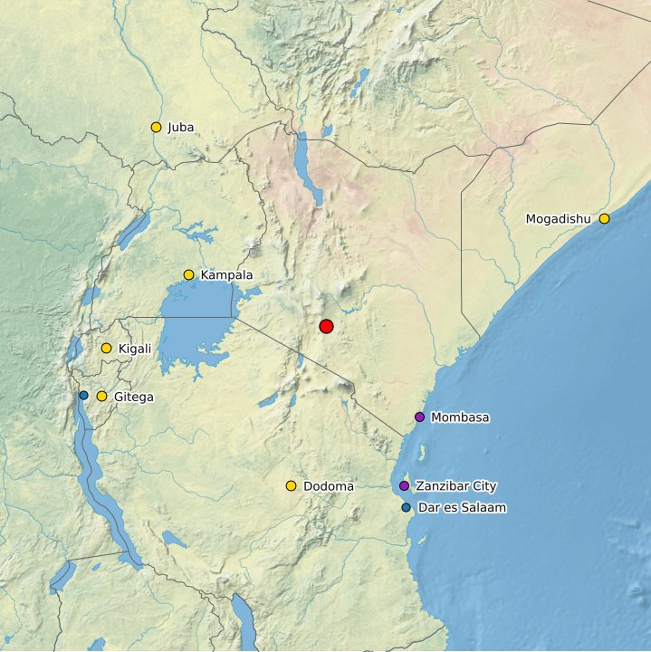
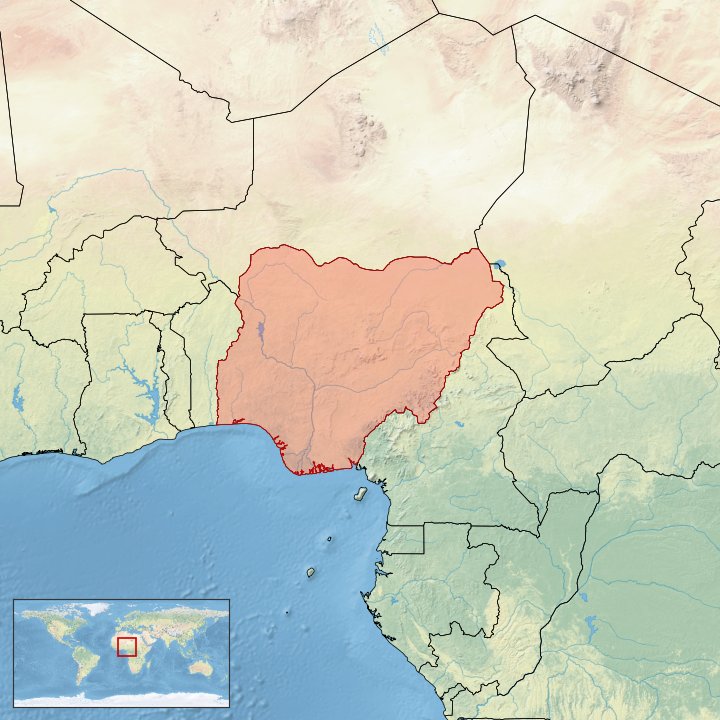
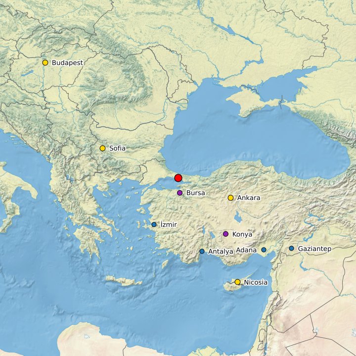
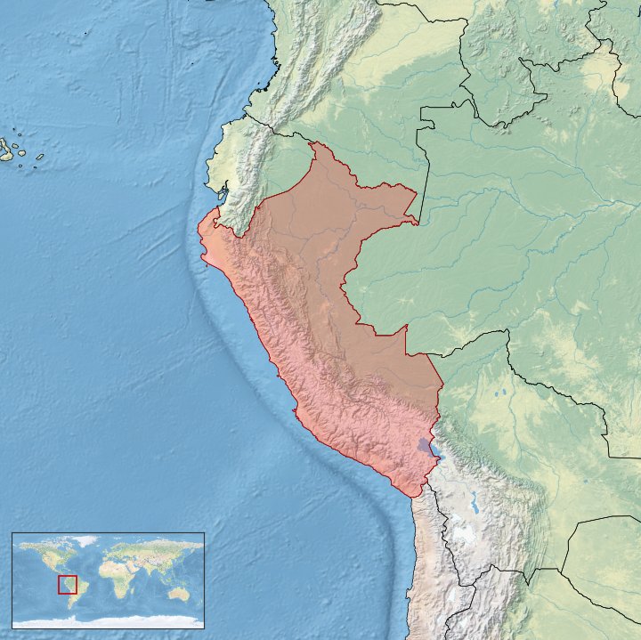
Three cities and three countries from the decks. Click to flip.
Curation
The first attempt was programmatic: rank cities by population, capital status, GaWC classification, and UNESCO presence, then take the top results. This approach was promising, but ultimately key cities of the world were missed and the resulting list was skewed towards large countries with many populous cities.
The final list is hand-curated. A CSV of notable cities from every country in the world, selected for a mix of political importance, cultural significance, geographic interest, and regional balance. Some worthy cities are probably still missing, and some inclusions are debatable, but the result is a more representative view of each country, and the process of finding each of these cities and deciding whether they were notable enough to include was a fun and educational exercise in itself.
How It Works
A Python pipeline takes the curated city list and:
- Enriches each city with data from Wikidata and GeoNames
- Generates a map image using Natural Earth raster imagery
- Packages everything into an Anki deck
Each card shows a map with a marked location on the front. The back reveals the city name, country, flag, continent, and contextual markers (capital status, UNESCO designation, global city ranking).
Current Status
Capitals, major population centers, and globally significant cities from every country in the world.
All 194 UN-recognised sovereign states. Each card shows the highlighted country polygon on a map; flip to reveal flag, capital, largest city, population, area, languages, and currency.
Natural features of planet Earth. First iteration covers mountain ranges; rivers, lakes, deserts, and more to come.
Downloads
Ready-to-import Anki packages. Anki is free on desktop, and available as AnkiDroid (free, Android) and AnkiMobile (paid, iOS).
How to import
Desktop (Anki for Windows / Mac / Linux)
- Download the
.apkgfile below - Open Anki, then go to File → Import
- Select the downloaded file — the deck appears in your collection immediately
Alternatively, just double-click the .apkg file and Anki will open and import it automatically.
Mobile (AnkiDroid / AnkiMobile)
- Download the
.apkgfile to your phone - Open the file from your downloads — it will open directly in the Anki app
- Confirm the import when prompted
If the file doesn’t open automatically, open Anki and use the import option from the menu (AnkiDroid: the three-dot menu; AnkiMobile: the downward arrow icon).
645 hand-curated cities from every country in the world, selected for political importance, cultural significance, and geographic interest. Each card shows a regional map with the city marked; flip to reveal the name, country, flag, and contextual markers.
Notable World Cities — Full ↓645 cards · 66 MBA lighter subset of the full deck covering more immediately recognisable cities. A good starting point if the full deck feels overwhelming.
Notable World Cities — Core ↓336 cards · 35 MBAll 194 UN-recognised sovereign states. Each card shows the highlighted country polygon on a map; flip to reveal name, flag, capital, largest city, population, area, languages, and currency.
World Countries ↓194 cards · 26 MBNatural features of planet Earth. Currently a prototype covering mountain ranges. Still requires significant improvement.
Natural Earth Features ↓54 cards · 5.8 MB